Newly-elected Northland Regional Council member Geoff Crawford, chair of the Taumarere Flood Mitigation Working Group, says that unlike most flood mitigation projects it is not about trying to ‘tame’ nature. “This one is actually restoring the Otiria Stream to its natural flow in accordance with new national freshwater ‘Te Mana o te Wai’ principles.”
Both Otiria and Waiharakeke sit above thousands of years-old lava flows which have been too hard for the streams to carve deep channels into. This meant in extreme flooding situations 70% of the flow from the Otiria Stream and 80% from the Waiharakeke River would travel across the associated flood plains.
The Waiharakeke River falls off the lava flow at Pokapu Rd into a series of waterfalls and over the years has carved out a massive canyon increasing the crosssectional area from just 36 square metres at Pokapu Rd to more than 600 square metres at Otiria Marae.” Councillor Crawford says it was the community that had, several years ago, come up with the idea of returning the water to its natural flow (as it was before any built infrastructure) into an area historically much better able to cope with the large volumes of floodwater.
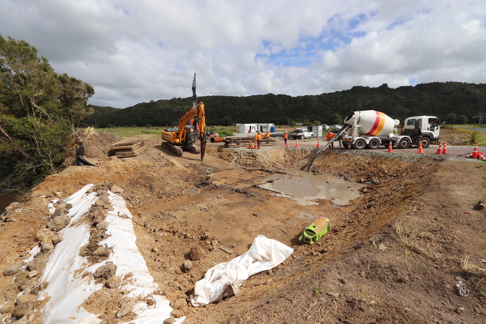
Stage I of the project – construction of the downstream section of a new $1.4 million 80-metre-long spillway at Otiria – was completed last year. Stage II is currently due for completion before Christmas this year and will see the replacement of an existing 18-metre-long road bridge with a new 60-metre structure, and effectively triple the flow of floodwaters that can pass beneath it.
“In previous floods this water would typically be diverted – in part by the existing bridge structure and railroad – downstream to land at Otiria and Moerewa.” A final and third stage will be completed at the same time as work on the bridge and will see excavation of the remaining 800-metres of spillway and the removal of the existing Pokapu Rd road bridge. The works cumulatively mean that in a flood, most of the water will be sent down the new spillway and into the Waiharakeke River past the lava flow, where the river is considerably wider and deeper.
The $7M total cost of the project is being funded 57% by Kānoa, the Regional Economic Development & Investment Unit, with another 28% met through targeted local and regionwide Northland Regional Council River rates. In recent months the project has secured a final 13% ($1M) from the Far North District Council’s ‘Better Off Fund’. When the project is finished, water will once again flow into the places it had for thousands of years before human influences.