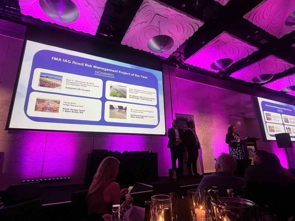
Congratulations to the rivers team at Northland Regional Council (NRC), landowners, mana whenua Ngati Kopaki-Ngati Te Ara Hapu, who received a Highly Commended award at the Floodplain Management Australia Excellence Awards on 15th May for their Otiria-Moerewa Flood Mitigation Te Mana o Te Wai project. The award was presented in front of around 500 people and faced tough competition for the FMA IAG Flood Risk Management Project of the Year Award.
This project was shortlisted against three other large Australian projects and showcased wide-ranging benefits of the collaborative, community-led flood protection initiative, guided by local hapū and the partnership of three Māori land blocks.
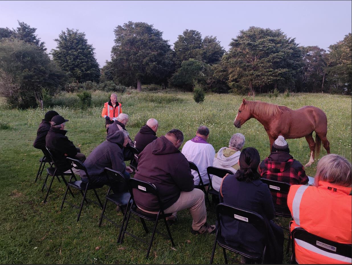
Above: The blessing of the Otiria-Moerewa flood mitigation spillway and bridge was attended by the local multi-owned Māori Landowners. This is the fourth bridge built on their land. The first railroad bridge built in the 1850s, then a road bridge upstream of the rail bridge in the late 1800s, an upgraded road bridge in 1960s and now the fourth road bridge to reduce flooding. The team led by Chantez Connor-Kingi, Kai whiri iwituna\Senior Advisor – Rivers, NRC, needed to mend emotional bridges before negotiating for land for the fourth bridge built on Māori-owned land. These negotiations took approximately 18 months, requiring many Hui with the hapu and wider community.
The Otiria-Moerewa Flood Mitigation project is safeguarding more than 1,800 residents, two schools, Kohanga Reo, playcentres, gas station and essential community facilities—all while respecting Te Mana o te Wai and integrating Mātauranga Māori with modern engineering solutions. Works included removing human-made obstructions and redesigning river pathways based on pre-human landscapes, leading to a 75% reduction in flood severity. 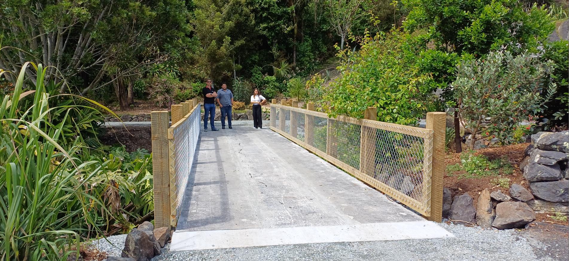
Above: The bridge above was part of the old Pokapu Road Bridge 3 of the 5 beams from the old 18-metre wide Pokapu Road Bridge were re-cycled. The other 2 were used for a farm bridge. The team were looking for innovative ways to reduce waste and give back to the community. The Quarry Gardens is a subtropical oasis created by volunteers in the remnants of a former quarry. It is a tranquil place to enjoy for a family picnic.
Through NRC’s innovative 'pre-human' flood model, NRC identified how roads and railways were impacting flood flow. The new spillway and bridge restore natural water pathways, integrating Matauranga Māori into LiDAR mapping and hydraulic modelling to create a holistic floodplain restoration strategy. The utilisation of natural flood management approaches, rather than infrastructure-heavy solutions, will also reduce long-term maintenance expenses.
This project is more than flood protection for Northland—it’s whenua preservation, environmental restoration, and a true partnership between iwi, councils, and engineering experts.

Above: Otiria Marae Cyclone Wilma, January 2011 – roads and railroads diverting overland flows. Photo by Murray Armstrong.